|
|
| Site Summary | ||||||||||||||||||||||
|
||||||||||||||||||||||
Site History
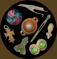
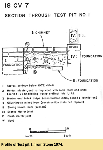
Archaeology In the 1960s, amateur archaeologists excavated around the ruins. One small collection from this period was later turned over to the Maryland Historical Trust, including a 1720 English halfpenny. Between 1971 and 1974, SMCC archaeologists did limited excavations around the house as part of their efforts to record the ruins. This work included one test trench and several smaller units. The archaeologists also recorded features exposed by the mason’s grading activities. Artifacts recovered at this time were cataloged at St. Mary’s City. They included porcelain, creamware, and whiteware sherds; lamp and bottle glass; and wrought and cut nails. In 2008, GAI Consultants, Inc. conducted a Phase I survey in a cultivated area west of the house ruins. They identified a concentration of prehistoric and historic artifacts designated “Site 17,” and the recorded boundary of 18CV7 was amended to include this area. The survey consisted of393 shovel test pits, initially excavated at 15-meter intervals then followed by supplemental testing in areas with artifacts. This identified a site measuring 213 x 366 meters. Only 67 of the STPs were positive, producing 169 historic artifacts and 5 prehistoric lithic artifacts. Most were found to the northwest of the house ruins. Nearly half were architectural artifacts like brick, window glass, and nails. Ceramics included whiteware, pearlware, yellowware, porcelain, and ironstone. There were also significant quantities of glass and oyster shell. Two buttons were recovered as well. The assemblage indicated an early 19th- to 20th-century domestic occupation. The STPs revealed an intact plowzone across the tested area, with a possible earlier plowzone or buried A horizon in the southern portions. No features were identified. Summary by Edward Chaney References
Archaeological collections from the Charles’ Gift/ Preston’s Cliffs site are owned by the Maryland Historical Trust and curated at the Maryland Archaeological Conservation Laboratory. |
||||||||||||||||||||||

|

|


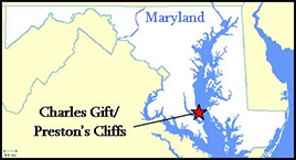
 The Charles’ Gift site, also known as Preston’s Cliffs (18CV7), is located on the grounds of the Calvert Cliffs nuclear power station in Calvert County, 0.2 miles from the Chesapeake Bay. During the second half of the 18th century, a square, one-story, two-room frame house (MHT #CT-59) was erected there on a brick foundation. Before 1810, the floor plan of the house had been altered, and a new doorway and chimney added. The building was enlarged between 1810 and 1830, with the new wing set on a stone foundation. In the late 19th century the south and west walls of the house were torn down and the building was expanded. Most of the chimneys were also replaced. The house was abandoned in the 1930s, and the Baltimore Gas & Electric Company (BG&E) acquired the property in 1966. BG&E hired the St. Mary’s City Commission (SMCC) to record the house ruins in 1971, and this study produced the architectural history of the structure. Because the house was in such poor condition, SMCC recommended that it be torn down and the stabilized foundation be made into an exhibit. Unfortunately, the mason hired to do the work graded the foundation down to its lowest corner, removing much of the soil surrounding the ruins in the process, and thus destroying numerous archaeological deposits.